BTT: Ibiza Extrem - High Level
Cycling a route of 82 km on a road bike does not seem to be a big problem for someone with a certain physical background and used to pedalling. In the case of mountain biking, however, it is a tough ride on two wheels, as is the case with this route. This route is such a hard day that some of its participants have described it as a "leg-breaker", not in vain only a third of the participants usually finish it.
From Sant Josep, we set off along a gentle area towards the first ascent to sa Capelleta, a climb where we will find it difficult to stay on the bike. Then we will find a quick descent followed by an ascent to the Sierra de sa Murta, from where we will descend along a series of paths that are not without some technical difficulty.
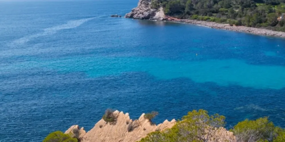
After passing through the neighbourhood of sa Carroca, we will go up to sa Capelleta again, this time on its eastern slope. The descent is through Benimussa to go back up another stretch of sa Capelleta along its northern slope. From here the descent begins to Cala Jondal along a series of tracks and paths through pine and juniper forests, before passing through the village of es Cubells, where we descend along the cliffs. At this point of the route we will pay the utmost attention as we will pass along a path on the edge of the sea.
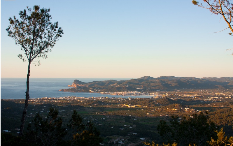
We will arrive at Cala Llentrisca where a climb begins along a stony path with a difference in height of 150 metres, which we will probably ascend on foot. At the top, a track with a similar gradient awaits us until we reach an altitude of 300 metres, where we will find a small flat area that will give us a slight respite. The ascent to Puig d'en Serra is very hard, as we will climb up to 415 metres in just 1.5 km (on asphalt). From here we will descend for a stretch and then climb the highest peak on the island, sa Talaia, 475 metres high.
The descent to Sant Josep is one of the best in the area, fast, through forest and with quite a steep slope. Once in the village, a stretch of track and asphalt closes the final loop.
To tackle this route in its entirety it is necessary to have a certain amount of training, to stock up on plenty of water and food, to wear a helmet, a machine with certain guarantees of not giving up on the first descent of stones and, above all, a lot of motivation.
Total distance - 82 KM
Estimated time - 8 hours
Technical difficulty - High
Physical difficulty - High
Overall difficulty - BLACK
- The route can be shortened by skipping the final loop, but it is advisable to enjoy it in its entirety.
- There is a natural spring during the second ascent to sa Capelleta where you will find water. Even so, it is advisable to stock up on food and water in abundance for this route.
- Be especially careful on the Cala Llentrisca path, next to the sea.
- We will take into account the length of the route, in order to foresee the hours of daylight. Just in case, however, it is advisable to carry back-up lights.
ROUTOMETER
1. Start. We start the route from Sant Josep along Can Cantó street towards the north. At the next crossroads, turn left and go uphill.
2. Cross left at the crossroads. There is a sharp bend in the road and we continue along the track on the left that descends. Further on we continue straight ahead next to the house, and then take the fork to the right.
3. Fork to the right. We reach a fork and continue to the right. 50 metres further on we turn left onto a path that descends, the next fork to the right and continue on the main path without turning off.
4. Left fork. At this fork we continue to the left, continue until we reach a track where we turn left and continue straight on until we reach a road where we turn right.
5. Turn right onto the track. At this point we turn right onto a dirt track, at the next crossroads we continue straight on, a little further on we continue on the right uphill and at the next crossroads we continue straight on.
6. Crossing to the left on the road. We reach a road and continue to the left. At the next three crossroads we continue straight on, without turning off.
7. Fork right onto a track. A fork appears and we take the track on the right. At the next fork we continue to the left until we reach a road where we turn right.
8. Crossroads on the right. We reach a crossroads and turn right. 100 metres further on we turn left onto a track where we continue without turning off.
9. Turn left onto a path. We turn left onto a stony path that ascends a steep slope (we will probably have to get off the bike). When we reach the top we reach a crossroads and descend to the right along a cemented path.
10. Fork left onto a track. We reach a fork and turn left onto what will end up being a track. At the next junction we continue to the right and follow the main track until we reach a road.
11. Cross left onto a road. We come out onto a road and turn left and after 10 metres we turn left onto a track. We follow this track until we reach a road where we turn left.
12. Turn right onto a path. At this point we turn right onto a path that descends. At the next crossroads we continue straight on until we reach the road where we turn right.
13. Turn right onto a track. A few metres from the previous crossroads we turn right onto a track. At the next two forks we continue to the right. We pass by the Casita Verde until we reach a road and turn left.
14. Turn right onto a track. Turn left onto a track and begin the ascent to sa Murta. At the next fork we continue to the left, ascending along the main track.
15. Left crossroads. We almost reach the top and continue upwards on the left, taking the next crossroads on the left and the next two on the right to start descending.
16. Turn left on the path. We turn left about 180 degrees to continue descending along a path. At the next crossroads we continue to the right. Further on we reach a crossroads where we continue straight on along the path that descends.
17. Crossing to the right. We reach a gravel track and continue descending to the right. At the next crossroads, turn right and continue along the same track without turning off until you reach a road, where you turn left.
18. Turn right onto a path. At this point we turn onto a path, parallel to the road, which descends along the stream until it joins the road 500 metres further down.
19. Cross the path straight ahead. We reach a crossroads and continue straight on along a path that crosses a stream until it ends in a street 1 km further down. Turn right along the street.
Turn right. After continuing along the street, we turn right. About 10 metres further on we enter a path on the left. We will reach a road where we turn left and then right onto a track.
21. Fork right. A fork appears and we continue on the right ascending to a track where we turn left. When we reach a road, we turn right and then left along a track.
22. Turn left onto a path. We turn left onto a path, which goes past several houses, until we reach a road where we turn left. At the next crossroads we turn right and continue along the road, without turning off, for 2 km.
23. Turn left onto a track. We turn off onto a forest track to the left where we will find a water spring a few metres away. This is where the ascent to sa Capelleta begins.
24. Turn left at a crossroads. Arrive at a crossroads and turn left up a path. A little further on, continue ascending along the main path on the right. When we reach the top (track next to a house) we descend to the right.
25. Crossroads on the left-hand side of the road. We reach this crossroads after the descent and turn left. After 100 metres we take a track on the left next to a house. At the next junction we go straight on, and at the next fork to the right.
26. Fork left. We reach a fork next to a house and continue to the left. A little further on we reach a path and start to descend to the right. We continue down the main track, without turning off at the crossroads.
27. Crossing to the right. We reach a dirt track, turn right and continue downhill. At the next fork we continue to the left. Further on we will find a crossroads, where we continue straight on along the asphalted road, without turning off.
28. Crossroads on the right. We come out onto the Sant Josep road but take a path on the right, which turns into a gravel track. You will reach the main road, cross it and continue straight on, passing by a bar. At the next two crossroads we turn left and follow the track without turning off.
29. Left turn. At this point we take a path that enters the forest on the left. When you reach a house with an impressive olive tree, turn right onto a path that starts to descend, entering the Cala Jondal trialera. We continue straight on along the path.
30. Fork right. We reach a fork and continue to the right along a hard path with stones. Further on we come out next to a house and continue straight on downhill. At the next junction we continue to the left and then straight on.
31. Turn right. We enter the forest again on the right. We continue through the forest without turning off. We will reach a crossroads where we continue on the left until we reach a house, where we go down a track on the left.
32. Crossroads on the right. We reach a road and turn right and a little further on turn right again and continue along a track without turning off. At the next crossroads with a road we turn right.
33. Crossroads straight ahead. Once at this crossroads we enter the countryside again on a track. At the next junction under the forest we turn right, right again and then left at the fork.
34. Crossing straight ahead. At this junction we continue straight on, and a little further on we turn left next to a house. At the next junction we take a path to the left, and 20 metres further on we turn left again, descending along a path.
35. Straight on. We find an alternative path but we continue straight on ascending until we reach a path and turn right. At the next junction we take the track to the right.
36. Crossroads straight ahead. We reach a crossroads where we continue straight on until we reach a road, where we turn right. At the next crossroads turn left to es Cubells.
37. Crossroads to the left. We reach es Cubells and turn left next to the church. Take a road with numerous houses, which runs southwest along the cliff for 3.5 km.
38. Cross the path in front of us. We reach the end of the road and continue straight on, taking a narrow path along the cliff until we reach Llentrisca cove. From here, we go up a path that goes off to the right and winds up a steep slope.
39. Cross right at the crossroads. Reach a track and turn right to continue ascending. If we turn right, we can visit a beautiful viewpoint.
40. Crossing to the right. At this crossroads we continue to the right and go straight on along the same track until we reach the top. We then descend for a stretch without turning off until we come out onto a road, where we turn right.
41. Left turn. At this point we turn left onto a road that ascends a steep slope through the forest.
42. Crossing straight ahead. We reach the highest point of the climb next to a house and continue straight on along a dirt track. At the next fork we turn right and continue straight on without turning off.
43. Turn left onto the track. We arrive next to some houses and turn left, along a track that descends.
44. Left turn. At this point we turn almost 180 degrees and take another track that descends. About 200 metres further on (next to a house) we descend along a path to the right that enters a wooded area.
45. Crossing to the left of the track. After crossing a stream we reach a track and turn left. At the next fork we turn left. We continue straight on without turning off for 1.5 km.
46. Cross the path straight on. We reach a point where the path is not very clear. We must follow the ascending path towards the north, which climbs up to a terrace. Once there, we will continue to the left.
47. Crossing to the right on the track. We reach a track where we turn right going upwards. At the next crossroads turn right and continue ascending along the same track without turning off.
48. Crossing to the right. We reach a crossroads and continue ascending to the right towards the top of sa Talaia. At the top we pass next to a repeater (television antennas) and continue straight on, descending a stretch.
49. Viewpoint on the right path. We reach the Sa Talaia viewpoint next to some antennas, where we take a path that descends abruptly to the right. At the next two crossroads we continue downhill to the left.
50. Crossroads on the right. At this point we descend to the right down some steps (we will have to get off the bike). Further on we turn right and reach a track where we descend to the right, until we reach an asphalted road that we follow straight on.
51. Crossroads on the left in the village. Arriving at Sant Josep, turn left along this street and at the next crossroads turn right.
52. Turn right. At this point we take a detour to the right, and 1.5 km further on (after passing in front of the sports centre) we turn right (next to a water tank).
53. Crossroads on the right-hand side of the road. We pass next to a quarry. We reach a road where we turn right and follow it until we reach a crossroads, where we turn left.
54. Turn right onto a track. We turn onto a track that goes off to the right. We continue straight on ascending progressively without turning off. 1 Km further on we reach a crossroads. We continue on the left.
55. Crossroads on the left. We reach a road and turn left and then turn left onto another road. About 50 metres further on we take a turning onto a road that descends to the right.
56. Crossroads straight ahead. We reach a crossroads and continue straight on along a dirt track. At the next fork, we continue to the left.
57. Closing of the loop. At this point we connect with the route during its ascent to sa Talaia. Continue along the same route to Sant Josep.
58. End of the route. We end the route in the village of Sant Josep.

